


Severe Storms Thrash Great Plains to Piedmont
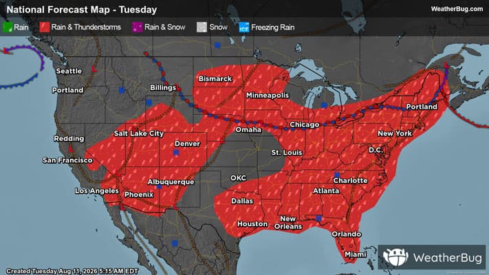
Multiple severe thunderstorm systems are expected to form today, running from the northern Plains to the Mid-Atlantic.
South of a stalled front, drawn over the heart of the Midwest, an unusually swift upper-level air pattern is pairing with humid, heated air to launch complexes of thunderstorms.
One complex of severe thunderstorms is already ongoing, born from Monday's severe activity and surviving overnight into central Appalachia. Through the course of the day, multiple other severe thunderstorm lines and complexes are expected to emerge along an alley from the Lower Midwest to the Mid-Atlantic.
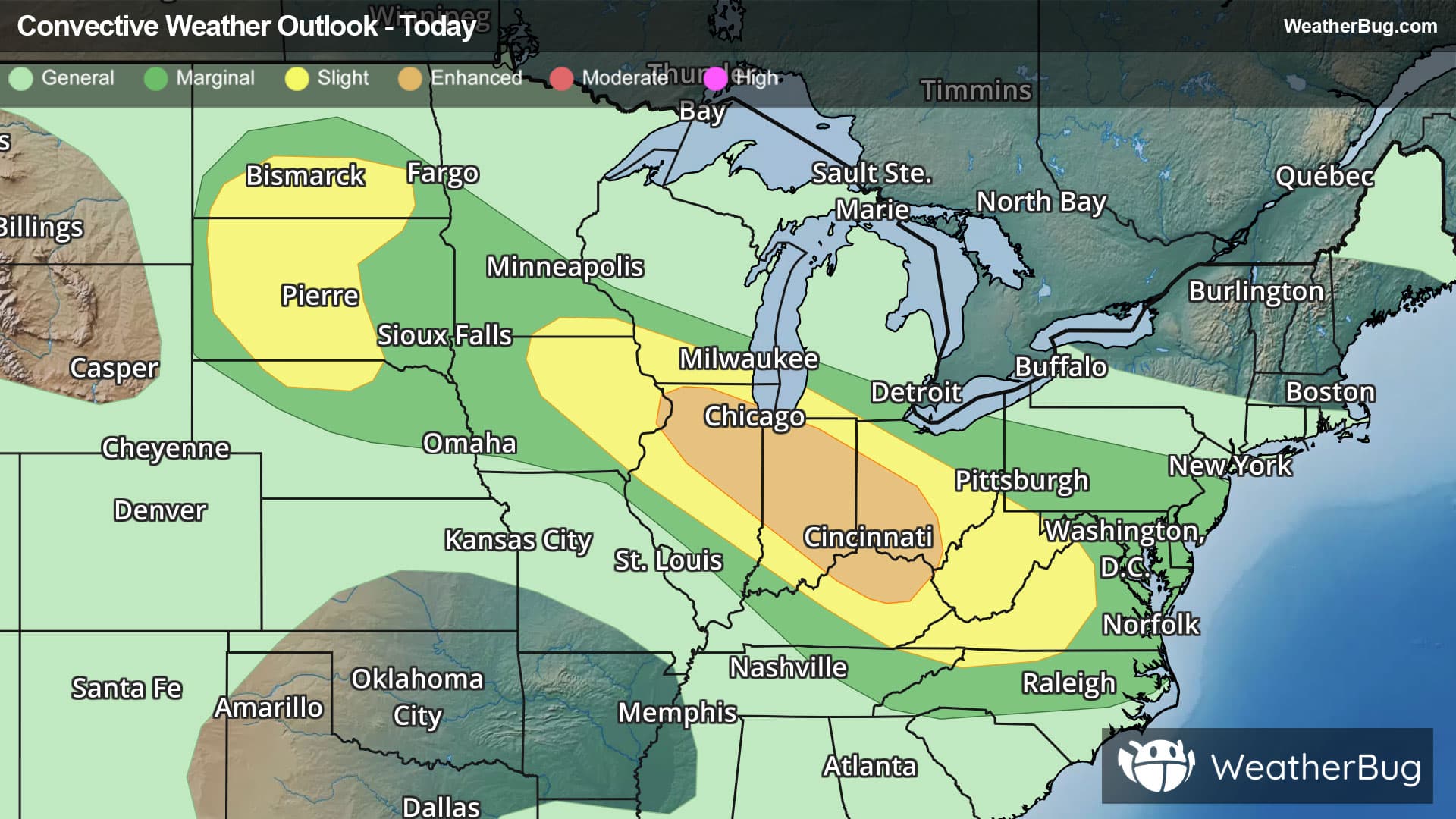
The government's Storm Prediction Center has issued an Enhanced Risk, or a 3 out of 5 on the severe weather probability scale, from far eastern Iowa and northern Illinois to northeastern Kentucky, southwestern Ohio, and far western West Virginia. Cities such as Chicago, Indianapolis, Ind., Cincinnati and Columbus, Ohio, and Lexington, Ky., are most at risk today, with widely scattered damaging gusts that could reach up to 75 mph or higher and a tornado or two possible.
An encompassing Slight Risk, a 2 out of 5, expands from far southeastern Minnesota and eastern Iowa through western Virginia and far northwestern North Carolina, including Cedar Rapids, Iowa, Madison, Wis., Springfield, Ill., Louisville, Ky., Charleston, W.V., and Roanoke, Va. Damaging winds remain possible for these locations, although their coverage and intensity are expected to be lesser. Even more sparse severe activity is possible in the Lower Mid-Atlantic this evening and overnight.
Additionally, Flood Watches have been posted from northern and central Indiana into West Virginia, southwestern Virginia, and far northwestern North Carolina.
The multiple rounds of heavy rainfall associated with severe thunderstorm lines today, which would amount to 2 to 4 inches of daily rainfall in localized areas, will bring flooding concerns to low-lying, urban, and poor-drainage areas. Remember, "Turn Around, Don't Drown!"
Not too far northwest, a separate alley of isolated severe thunderstorms, mainly taking the form of supercells, is likely in the northern Plains. Storms forming here have the ingredients for not only damaging wind gusts, but for large hail that could exceed two inches in diameter as well.
As such, there is a separate Slight Risk for north-central Nebraska to south-central North Dakota, covering cities and towns including Valentine, Neb., Rapid City, S.D., and Bismarck, N.D.
Severe thunderstorm risks will continue into the workweek, sinking southward on Wednesday into the central Plains and Southeast as well.
Be sure to know the difference between a watch and a warning. A watch means that the conditions are in place to possibly produce severe weather conditions, while a warning indicates that those conditions are currently occurring. Be sure to have multiple ways to receive warnings, as storms will be occurring late tonight. Also, take caution if you are outdoors during a thunderstorm. Remember, “When Thunder Roars, Go Indoors!”